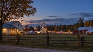
Ramara’s stretch of Lake Simcoe — from the Narrows across from Orillia, past Bayshore Village, to Brechin and Lagoon City — has no single character. The shoreline changes bay to bay and sometimes lot to lot: rock to sand, shallow to deep, south-facing to west-facing. Some lots may accommodate a larger boat at a shore wall; others are shallow sand flats you can walk out on for hundreds of feet. Most of the shore is on well and septic, with municipal sewer service available in parts of Brechin, Lagoon City and Bayshore Village.
I know this shore well. What follows is what I’d tell a friend who was thinking of buying here.
The shoreline changes bay to bay
There is no “typical” Ramara waterfront lot. Within a short drive you’ll find:
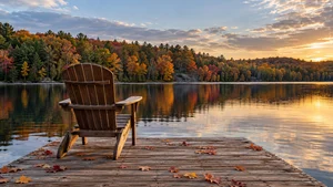
- Rock at the shore, then sand. Many lots start rocky and transition to sand not far out. In my own bay, it’s rock at the water’s edge turning into hard-packed sand a short way out.
- Gradual to deeper water. Some shorelines go from moderate to deeper water over the first 40 to 50 feet.
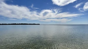
- Long, shallow sand. Other stretches stay shallow for hundreds of feet — you can walk straight out on pure sand. Great for young kids and wading; harder for a big boat.
- Soft, mucky bottom. Some areas, especially behind shoals and in sheltered corners, are soft and dark underfoot. In one corner of my bay, once you cross the shoal, the water turns mucky and dark — it feels like stepping into prehistoric times.
What that means for a buyer: two lots on the same road can offer completely different swimming, boating and dock options. See the shoreline in person, walk it, and — if the water matters to you — look at it in the fall.
Water levels change through the season
Lake Simcoe and Lake Couchiching are lowered each year under a guideline Parks Canada calls a “rule curve,” which makes room for winter snowmelt and precipitation (Parks Canada).
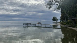
Here’s one example of what that looks like. My own dock runs about 24 feet out. In summer there’s two and a half to three feet of water at the end of it; in the fall it can be down to a foot or a foot and a half. Your dock won’t match mine. The point is that the water you see in July is not the water you’ll have in October.
If you are buying in summer, ask what the water does at that dock in October. If you are buying in the fall, don’t write off a shoreline that looks shallow — ask what it’s like in July.
Exposure: south light and west sunsets
Much of the Ramara shore faces south, which means sun most of the day. But the coastline bends, and pockets of it face west:
- Some bay corners face west, with long sunset views.
- From Bayshore Village, you look out over Strawberry Island.
- Around Brechin, the shore turns west-facing again.
If sunsets matter to you, check the exposure on the lot itself. The township-wide direction won’t tell you.
Along the shore: three different places
The Narrows, across from Orillia
The shoreline along the Atherley Narrows sits on the channel that connects Lake Simcoe and Lake Couchiching, part of the Trent–Severn Waterway’s main route. The Narrows has some substantial properties with channel frontage, and you are just over the bridge from Orillia. Locally, part of it has long been known as Millionaire’s Row. Depth still needs checking at the individual lot.
Bayshore Village
A lakeside community served by one of the township’s two wastewater treatment facilities (Township of Ramara), with views across the lake toward Strawberry Island.
Brechin and Lagoon City
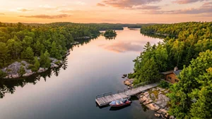
Around Brechin, the shore turns toward the west, and then you reach Lagoon City — a community built around canals, with a marina and direct access out to Lake Simcoe.
- Along Paradise Boulevard and Old Indian Trail, before the bridges, some properties may accommodate larger boats at their shore walls. Check the depth, the mooring rules and the route for the particular lot and boat — Ramara regulates mooring in the Lagoon City canals by bylaw (Township of Ramara).
- Inside Lagoon City, your boat has to clear the car bridges or the walking bridges to reach your lot. Measure your boat’s clearance before you fall in love with a canal property.
- If your boat cannot clear the bridges, ask the marina about an available slip with access to Lake Simcoe. Confirm the boat’s dimensions, the route and the marina’s terms before relying on that option.
Fishing
The fishing here is very good. Pike and bowfin — often called dogfish locally — are among the fish I’ve encountered here.
Services, roads and winter
- Sewers: municipal sewer service is available in parts of Brechin, Lagoon City and Bayshore Village (Township of Ramara). Confirm the connection for the specific property — being in the community doesn’t mean the lot is hooked up.
- Everywhere else: most waterfront along the Ramara shore is on a private well and septic. Budget for inspections, water testing and the septic’s records as part of any purchase.
- Roads: some roads along the water are still gravel. Ask who maintains the road and how it’s handled in winter.
- Drive times: from my part of the shore, Orillia is about 15 minutes. From Brechin, figure 20 to 25. From the Narrows, you’re just over the bridge.
Who it suits
Buyers who choose the Ramara shore tend to want real Lake Simcoe waterfront, a range of shoreline types to choose from, and easy access to Orillia. The thing to remember is that one lot doesn’t tell you about the next: two lots on the same road can offer completely different swimming, boating and dock options.
Before you buy on this shore
Everything above describes the shoreline. It doesn’t tell you what a particular property owns. Shore road allowances, access rights and water lots all matter here too. See Part 1 of our Lake Simcoe buyer series for what to verify, and our Lake Simcoe waterfront guide for the rest of the lake.
Thinking about the Ramara shore? Book a private consultation or call me at (705) 242-5764 — I’m happy to walk a shoreline with you.
Bill Jackson · Sales Representative · Lake Country Real Estate Team · eXp Realty, Brokerage
Last reviewed: 29 September 2026